

This weekend we had intended on going on the Multnomah-Wahkeena Loop Hike. Unfortunately, I did not check the weather for the right town near Multnomah Falls, and we found conditions to be less favorable than I enjoy. Temperatures were in the mid 40’s and it was raining. This meant that we only hiked up to the top of Multnomah Falls and then came back down. It was still an experience, and well worth the discomfort of being in the cold and damp rain.
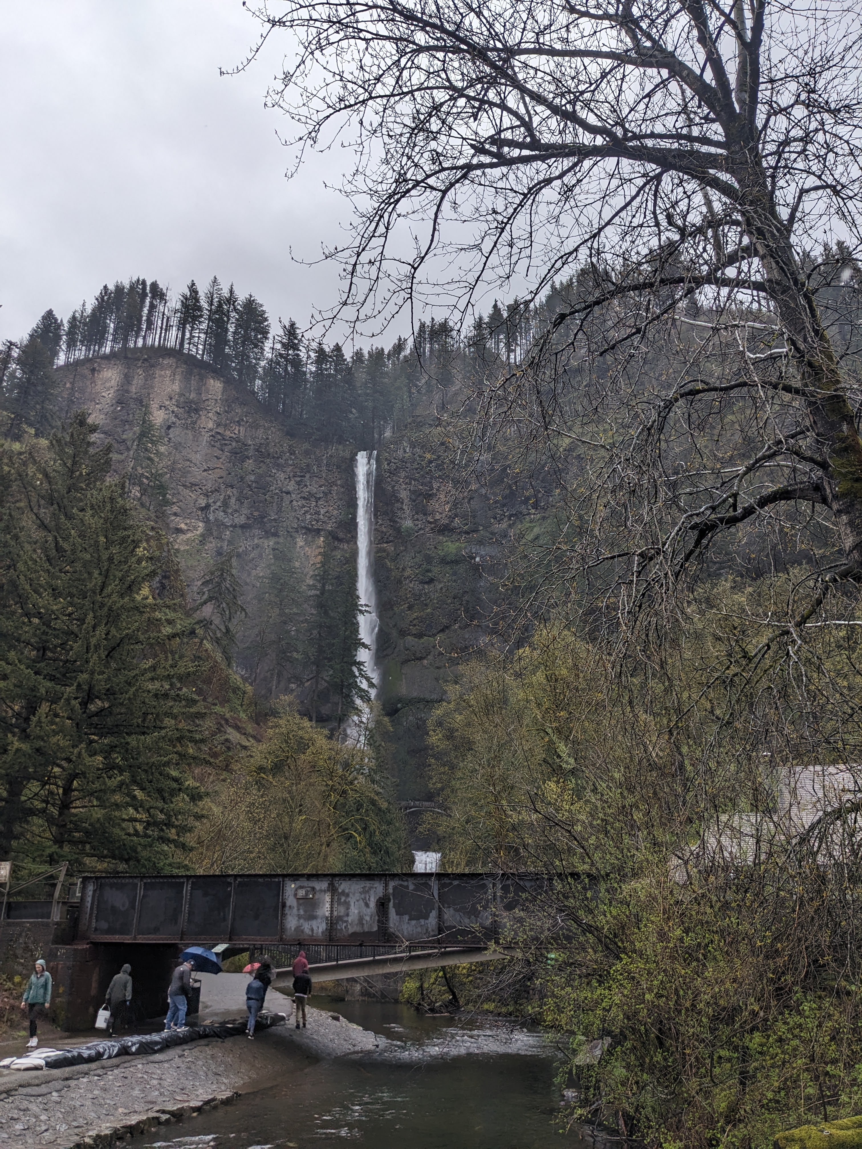
Getting to Multnomah Falls is relatively simple. The parking area is roughly 31 miles east of Portland on I-84. It is in the median of the freeway, so you will want to be in the left lane regardless of whether you are traveling east or west. As soon as you park and look to the southeast, you will see the falls cascading downwards. Walk to the southeast corner of the parking lot and you will find a tunnel going under the freeway that leads to the Multnomah Lodge area. From the lodge, you simply have to start following the paths leading upwards.
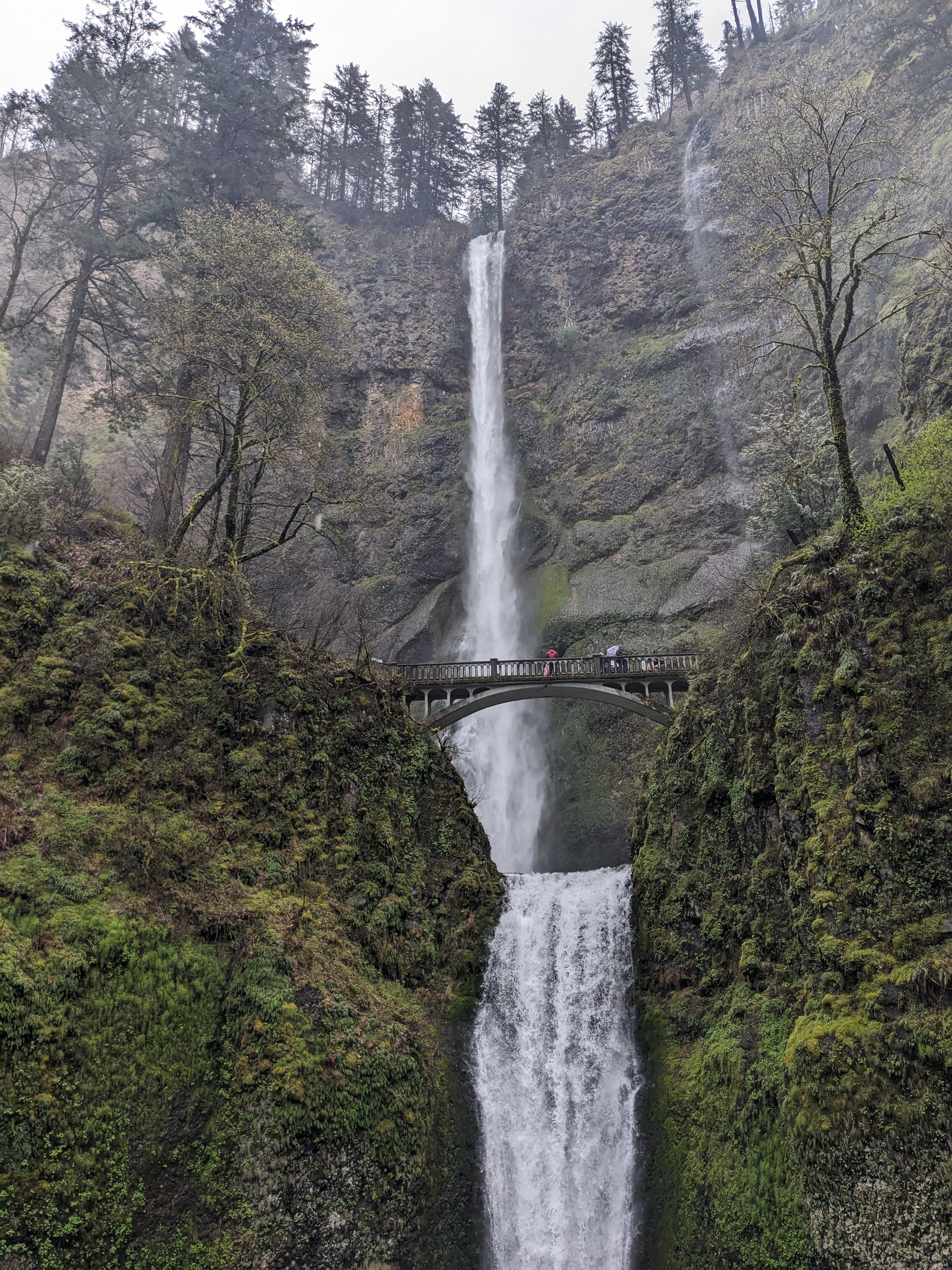
After getting your first good view of the falls and Benson Bridge, continue following the path upwards until you are able to get onto the bridge itself. There are two viewing areas, one on either side of the bridge. Be patient and polite as everyone wants to stop on the bridge and take a selfie with those they came with. After you are able to get across the bridge, there will be another viewing area about ten feet higher than those by the bridge. You are also closer to the waterfall and are more likely to get into the mist from the falling water.
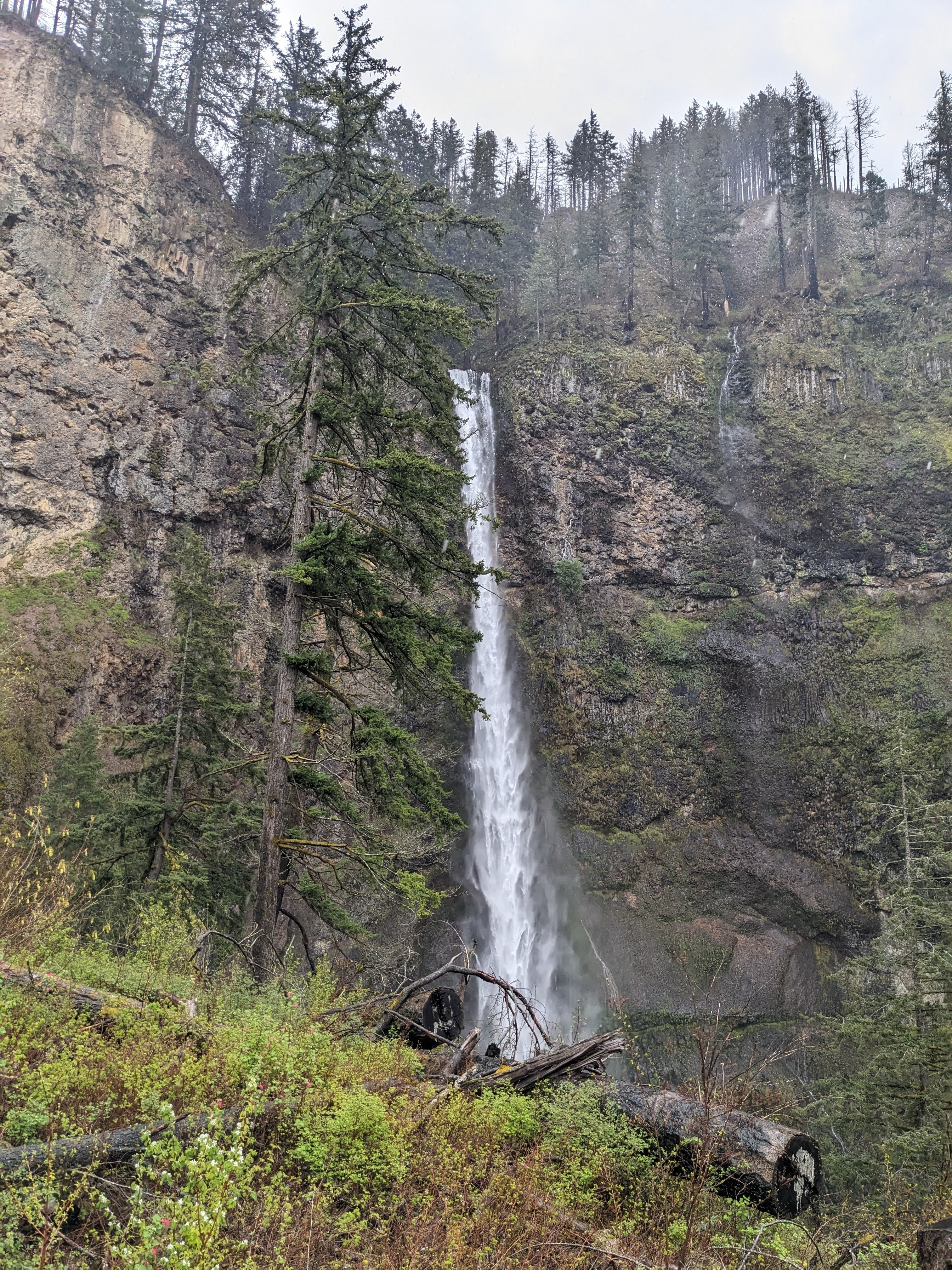
There are a few more nice viewpoints from which to view the falls as you continue following the trail upwards. All told, you will traverse 1.2 miles and 11 switchbacks in order to reach the topmost viewpoint. If a view from the top of the falls is not on your agenda, you can continue on the trail and choose to walk to Larch Mountain or do the Multnomah-Wahkeena trail. I cannot speak more of this trail at this time, but here is a link to the Forest Service page that has maps and more accurate information than I can provide: https://www.fs.usda.gov/recarea/crgnsa/recarea/?recid=30026 .
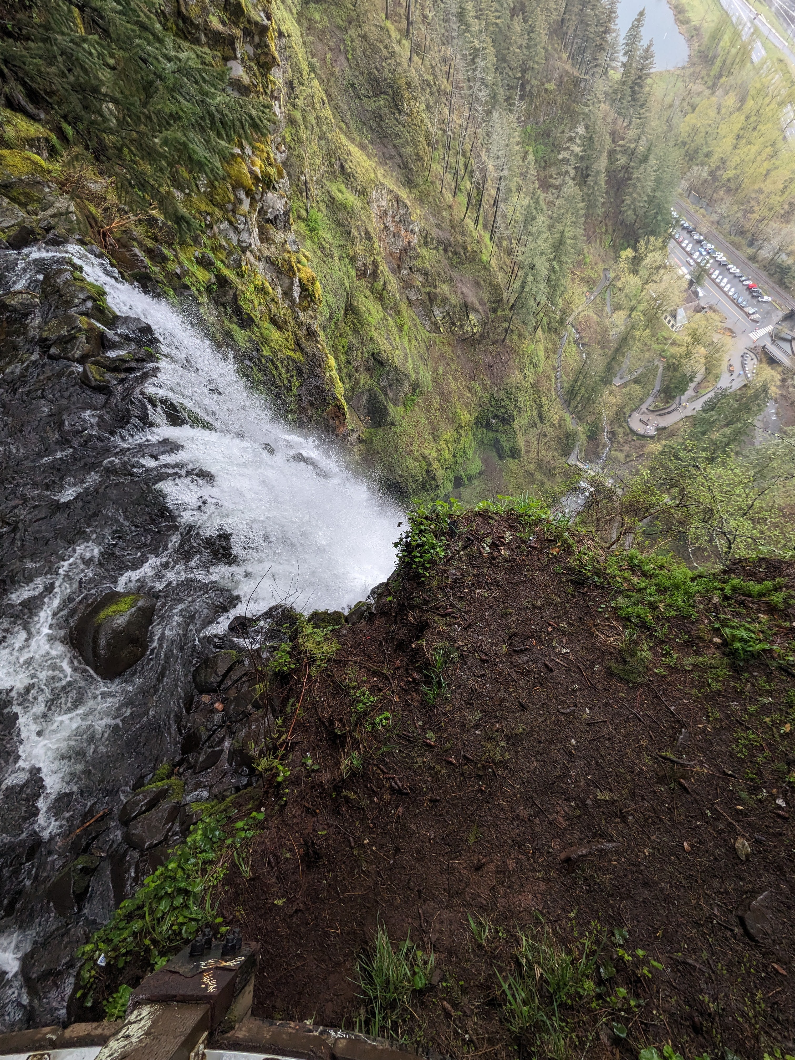
Overall, I think that this is a worthwhile hike to embark upon. While there is quite the elevation gain and it is crowded, the views (not just of the falls, but of the surrounding Columbia River area also), make it worth the effort. It is readily accessible to anyone with a car and there are so many different hikes and waterfalls that can be accessed just from this one area. Of note, this park has ticketed entry from May 24, 2024 through September 2, 2024. The ticket is only $2, so it is not cost prohibitive, but it does speak to the volume of visitors to the area that they had to initiate this process. If you go in peak season, be prepared for lots of tourists and crowded trails. Leashed dogs are allowed in the facility, so expect to see many canine companions as well. Have fun and be safe adventuring out there!
If you want more content, give me a follow on Instagram at: overnightadventuresblog
If Facebook is your thing, here is my page: https://www.facebook.com/overnightadventuresblog/
More videos to come on YouTube at: https://www.youtube.com/@OvernightAdventuresVlog
And finally, if you would like to help support my travels and this blog, as well as getting access to media not available at other sources, here is my patreon link:
https://www.patreon.com/OvernightAdventures
Disclaimer: The information contained in this blog is for informational purposes only and is not intended to be a substitute for professional advice. The author of this blog makes no representations or warranties of any kind, express or implied, as to the accuracy, completeness, or suitability of the information contained in this blog for any particular purpose. The author of this blog will not be liable for any loss or damage arising out of the use of or reliance on the information contained in this blog.
Copyright 2024 Isbell Productions

You must be logged in to post a comment.