

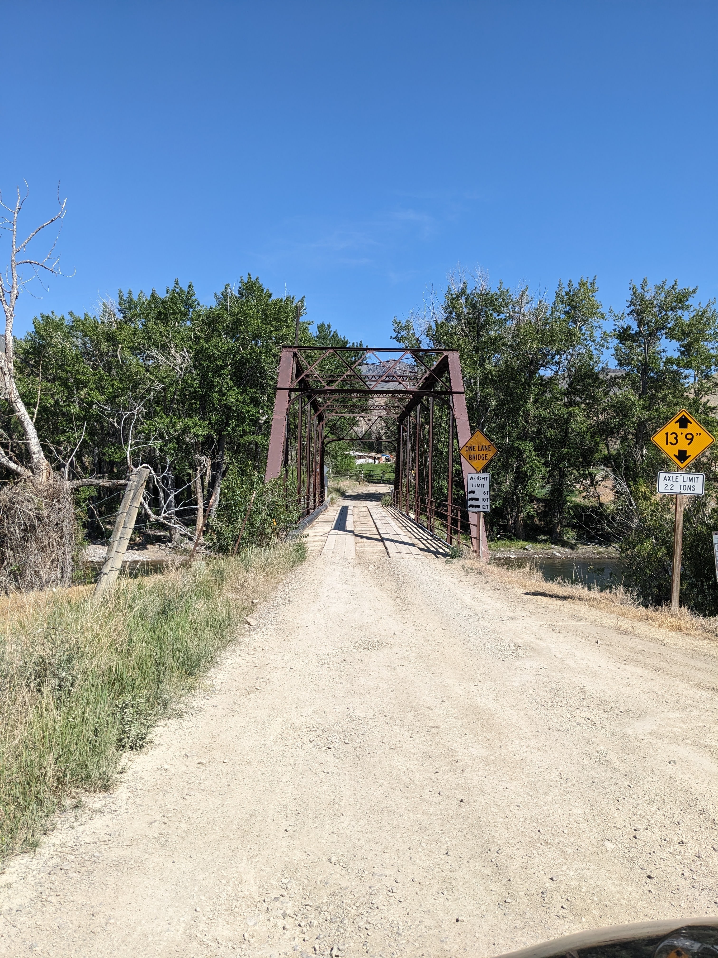
After a restful night of sleep at Bayhorse Recreation Area, we decided to check out the Bayhorse Ghost Town before heading onward to McCall, Idaho. Bayhorse Creek Road is roughly 11 miles southwest of Challis, Idaho, on ID Hwy 75. The ghost town is located about 4 miles up Bayhorse Creek Road. The road is a little rough, but careful plotting of the path got us to our destination. There are some large rocks embedded in the road as well as a lot of scattered rocks along the dirt path. High clearance vehicles will have no issue with the road.
As most adventures start, we found ourselves in a parking lot with a vault toilet and a fee station. The toilets were nice, altho it was not super warm yet when we arrived. The entrance fee to the park is $7 unless you have an Idaho State Park sticker. After paying our fee and grabbing all the information available for a self-guided tour, we embarked upon a little perusal of the park.
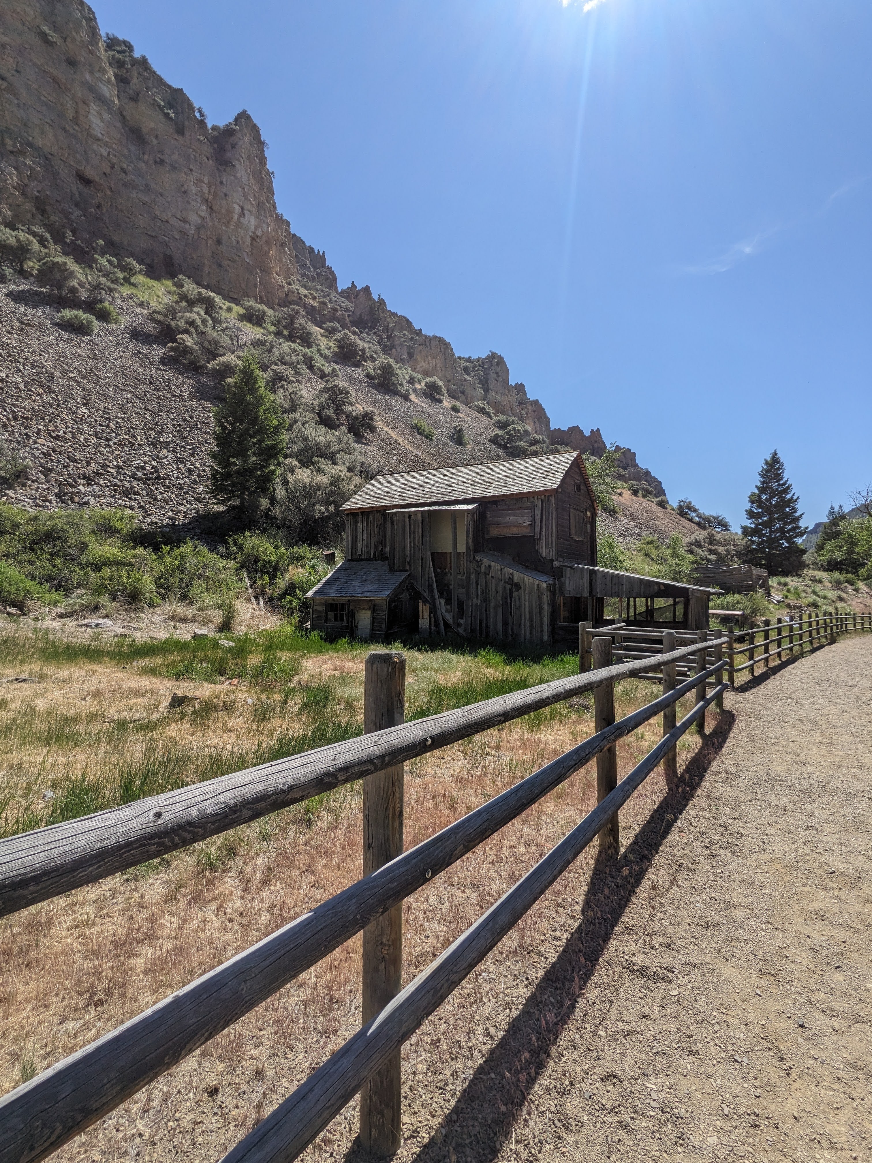
Considering that the town was established in the late 1860’s, there was still quite a bit left for us to see. There were a few old homes still standing as well as the Bayhorse Hotel and the Michael Sargent Store. One of the better preserved buildings was the Wells Fargo building. One of the more recent buildings was supposedly moved to the location in the 1920’s or 1930’s. The mill is still mostly standing, but as we could not get inside the building, it could just be the outer structure that remains mostly intact. There was a lot of ‘garbage’ that remained as well, which was sort of poignant as it shows just how long our mistreatment of an area can last, but was also interesting because it let us see what was important in everyday use back then.
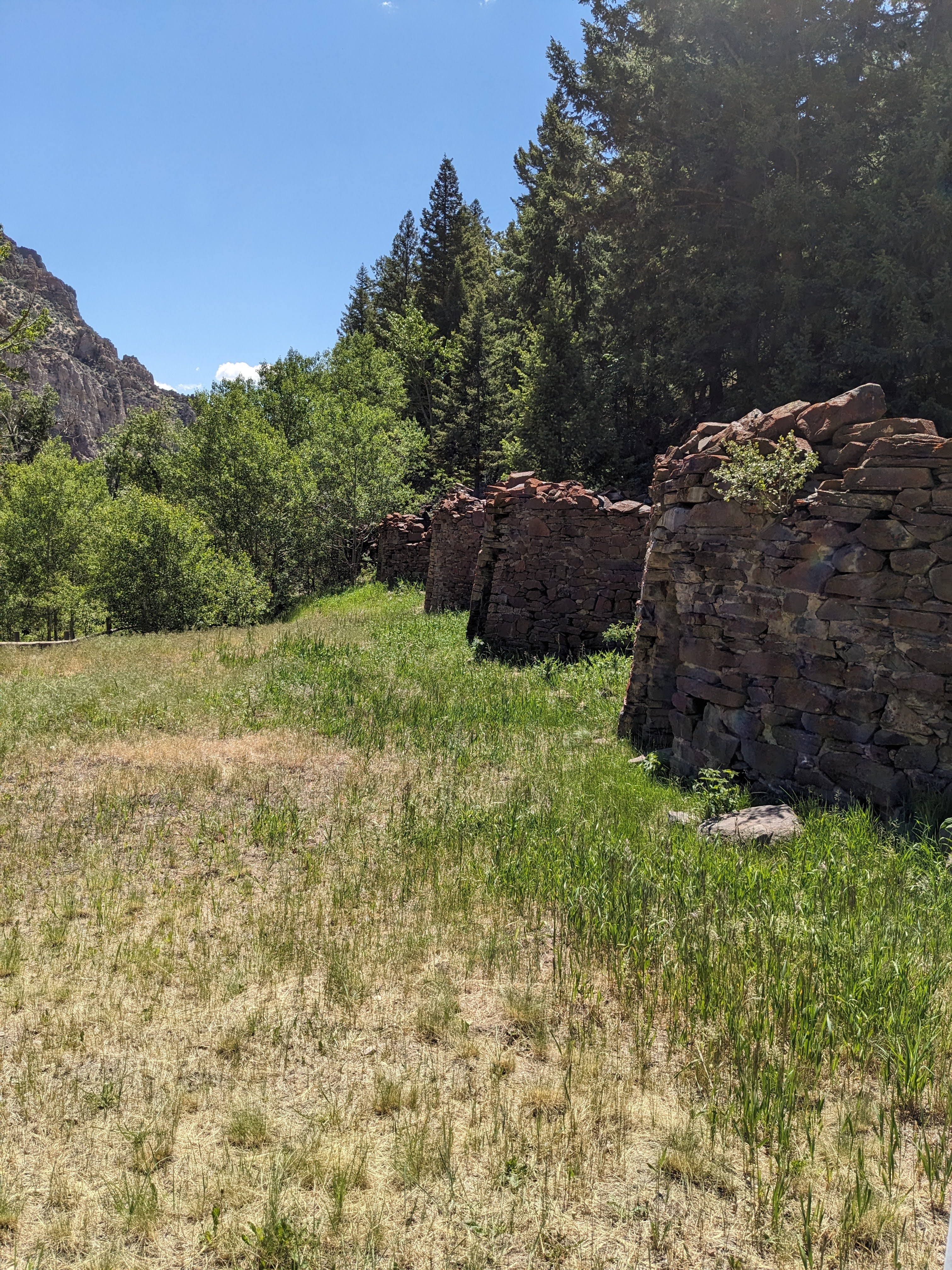
As temperatures rose and the air grew drier, I was struck with a deeper appreciation for the hardiness of the folk who use to make a living working the mines in this area. While it might have been much cooler underground, there was still work that needed to be performed above ground, and much of that required the use of heat in an already warm environment. The remains of the stone kilns used to create charcoal still stand, their roofs collapsed inwards. The charcoal was used to refine the mostly silver and lead ores that were mined in the area.
Bayhorse Ghost Town was a nice little diversion from our planned trip home. I always enjoy seeing how the old timers survived and the stuff that they left behind. I heard there are better, more well preserved ghost towns in the area, but if you want to make a little side trip to check this one out, I do not think you will be disappointed. There is also a hike up the mountain that takes you to several different mine shafts. The trail does seem accessible to OHV’s under 50″, so if you are on a bike or a quad, you do not even have to make the hike.
Official website for Land of the Yankee Fork .
If you want more content, give me a follow on Instagram at: overnightadventuresblog
If Facebook is your thing, here is my page: https://www.facebook.com/overnightadventuresblog/
More videos to come on YouTube at: https://www.youtube.com/@OvernightAdventuresVlog
And finally, if you would like to help support my travels and this blog, here is my patreon link:
https://www.patreon.com/OvernightAdventures
Disclaimer: The information contained in this blog is for informational purposes only and is not intended to be a substitute for professional advice. The author of this blog makes no representations or warranties of any kind, express or implied, as to the accuracy, completeness, or suitability of the information contained in this blog for any particular purpose. The author of this blog will not be liable for any loss or damage arising out of the use of or reliance on the information contained in this blog.
© 2024 Isbell Productions. All rights reserved.

You must be logged in to post a comment.