
This weekend was a little more chill for Rebecca and I. We chose to stick around home this weekend and did not go camping at all. After a visit to the farmers market in Moscow, ID, we headed out to Troy, ID. We made a left off of eastbound ID Hwy 8 onto Big Meadow Rd and then another immediate left onto Randal Flat Rd. We stayed on Randal Flat until we turned right on Tamarack Rd. We continued on this gravel road until we found a nice spot to park about 1/4 mile below the gate that denotes the start of the trail. This was a large, flat area that was easily accessible. There is parking near the gate, but the road is much rougher at that point and 1/4 mile is not that much extra to walk.
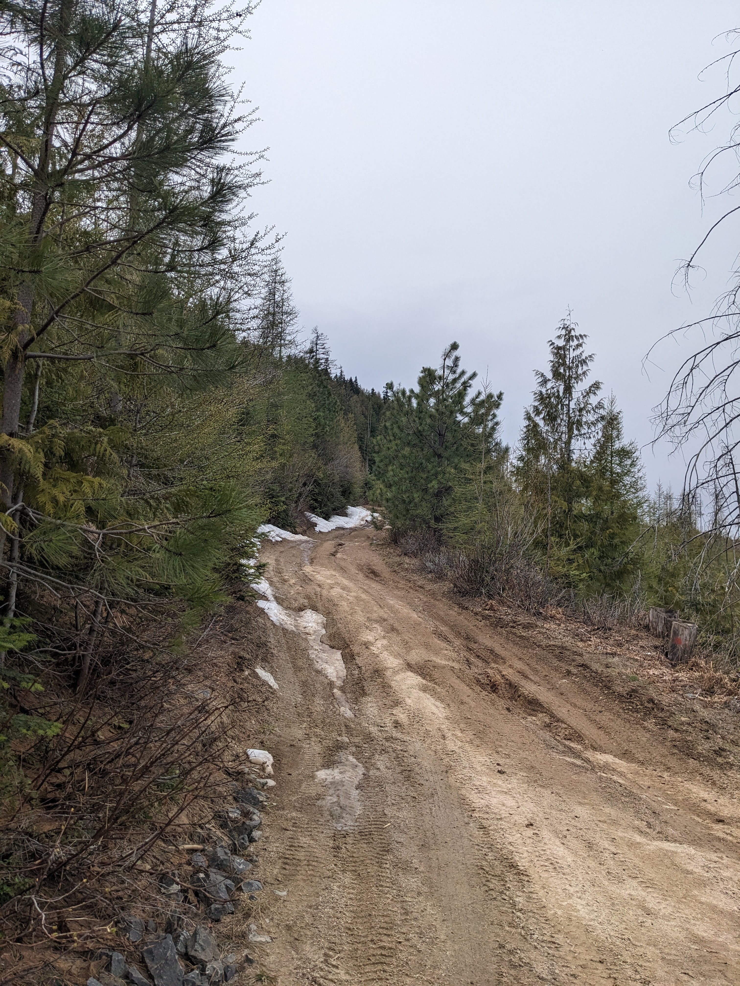
We embarked on an immediate uphill climb along a disused forest service road. AllTrails denotes this hike as moderate, so it definitely got our hearts pumping. We met a few other hiking groups on our way up the hill, and a couple had dogs. I believe that I read somewhere that it is suggested to leash your dogs. After a little bit of hiking, we moved onto the northern side of the mountain and found the road still covered in about a foot of snow. We continued onwards, and eventually found ourselves clear of the snow and back onto clear roads.

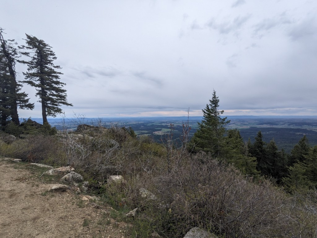
We were unaware of the road that leads to the nearby red cedar grove and picnic area, so we continued on to the summit. Standing at the top where a long ago dismantled lookout stood, we were able to take in views of most of the southern mountain ranges that we know. The Seven Devils, Blue Mountains, and Wallowa Mountains loomed in the distance. We enjoyed the views and explored the space a little before heading back down the hill.
From what I have read, the land is private land. There were many more roads branching off, but these were gated and locked. I think it is probably best practice to stay on the open roads and not risk losing the rights of everyone to use this land at the generosity of the land owners.
This hike was well worth the time and effort as the views that it afforded were quite awesome. I think that the reason for this 4.6 mile hike being as difficult as I felt it was is because you are either going up, or you are going down, there is not really a reprieve from one or the other until it is over. I saw that there are a few mountain bike trails as well and assume that those who are into that scene would have much more information on the trails around the area. Parking is free and it does not appear that any park permits are required to enjoy the mountain.
If you want more content, give me a follow on Instagram at: overnightadventuresblog
If Facebook is your thing, here is my page: https://www.facebook.com/overnightadventuresblog/
More videos to come on YouTube at: https://www.youtube.com/@OvernightAdventuresVlog
And finally, if you would like to help support my travels and this blog, here is my patreon link:
https://www.patreon.com/OvernightAdventures
Disclaimer: The information contained in this blog is for informational purposes only and is not intended to be a substitute for professional advice. The author of this blog makes no representations or warranties of any kind, express or implied, as to the accuracy, completeness, or suitability of the information contained in this blog for any particular purpose. The author of this blog will not be liable for any loss or damage arising out of the use of or reliance on the information contained in this blog.
Copyright 2024 Isbell Productions

You must be logged in to post a comment.