

Nisqually John Canyon is a habitat management area in Washington state that is open to hunting and fishing. The area is also open to hiking, which is how I used it. To get to the parking area, you need to get on Wawawai Rd and keep an eye out for the parking area sign that points away from the river (I think it is the only such sign along the entire stretch of Wawawai Rd.). If you are coming from Clarkston, it is a short ways after the Nisqually John Canyon. If you are coming from Pullman, it is before the aforementioned landing area. If you go too far, you may as well use the landing area toilets because those are the closest ones to the trailhead.
The trail starts off nice and wide at the trail head, being an abandoned jeep track. After about 1/2 a mile it narrows down to a nice little single track. There is a portion that is tremendously muddy shortly after it narrows down. There are rocks and planks to try to keep your feet out of the mud, but thankfully the section is only about 100 feet or so long. Blackberry bushes encroach upon the trail, making it hard to try to go around, or find something safe to grab for help with balance. If you should step off, as my partner did, the mud is about 3 inches deep, so be prepared for that.

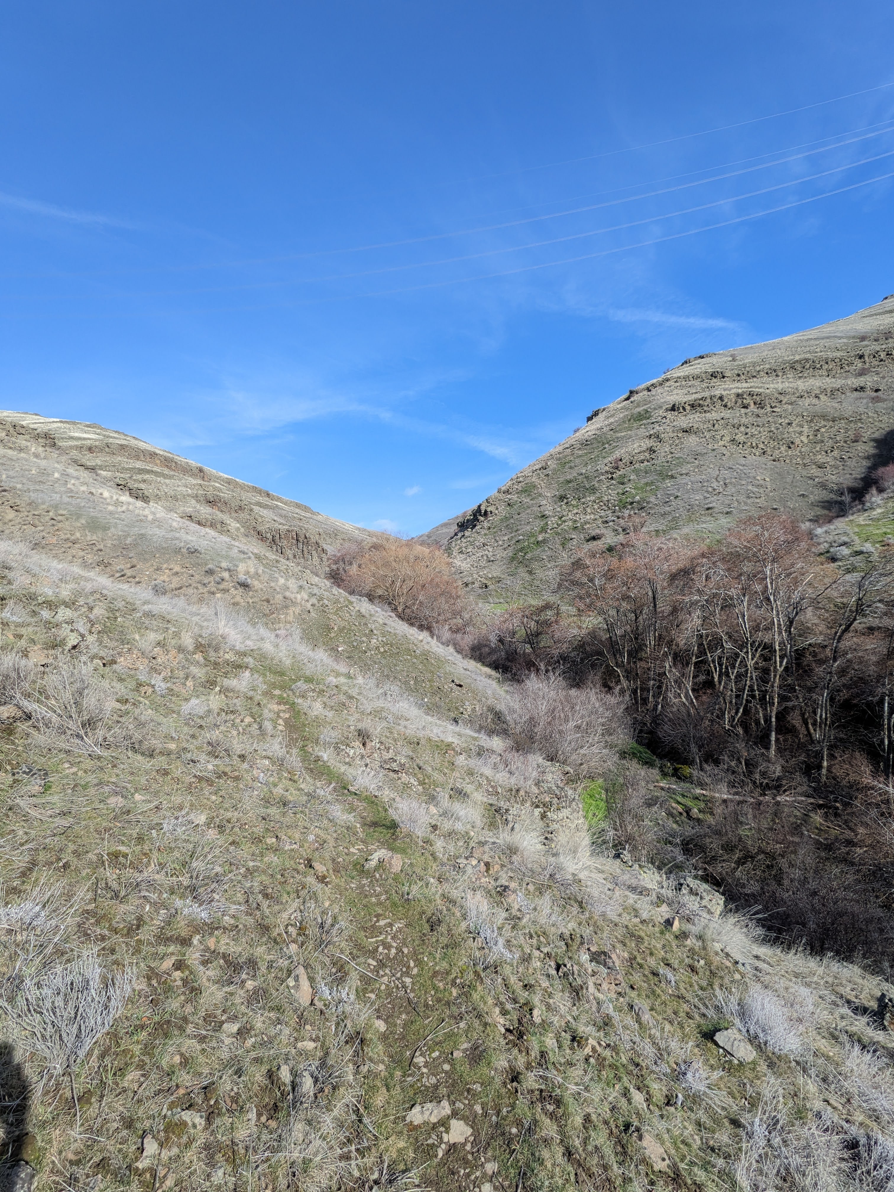
There is a creek in the bottom of the canyon. This provides a great deal of brush and tree cover for wildlife. While the wildest thing we saw was a small mouse and some cows, there did appear to be deer prints and scat along the trail as well. I am sure that during the warmer months there are probably a lot of birds to watch also.
The trail is about 2.5 miles from parking lot to farmland marked as private property. Elevation gain is roughly 1500-1800 feet depending on where you look. We did not make it to the end of the trail as the area began to become questionable with rock piles and steep muddy hillsides, but we did gain 1300 feet in the 2.1 miles that we covered. There were a few times that the trail splits, with one spur leading up hill and the other down towards the stream. I would advise taking the higher ground so as to avoid having to crouch walk through the blackberry bushes and thick undergrowth near the creek at one of the more northern points.
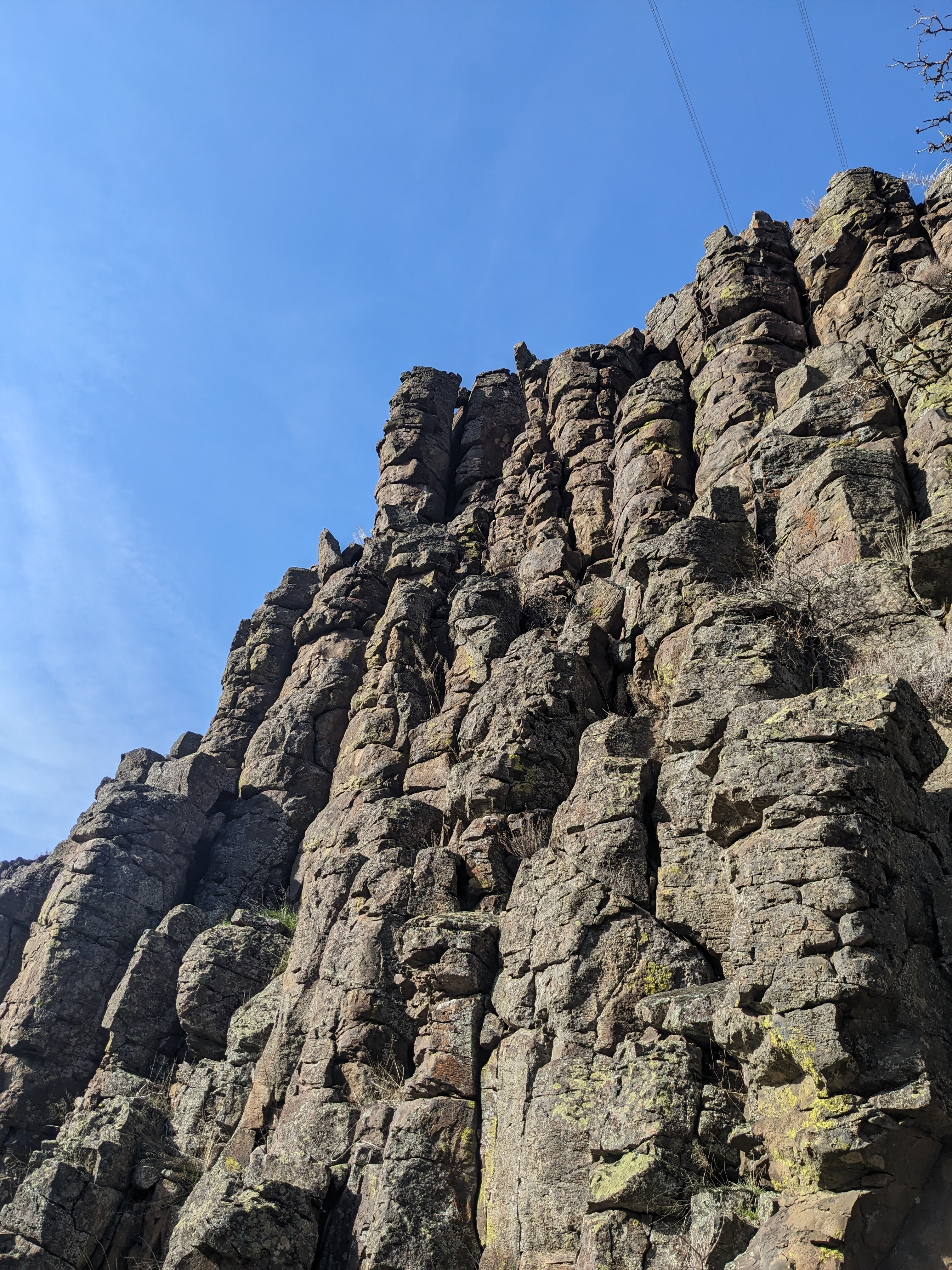
I would say that this hike is very much worth the time, especially in the winter months when temperatures are lower as there is not a lot of shade along the trail. The geology of the area is a major high point, as well as the occasional grassy area where you can chill and enjoy the scenery for a moment. Asides from the sketchy areas where rocks seem to have slid across the trail and the muddy section, the trail is quite decent.
If you want more content, give me a follow on Instagram at: overnightadventuresblog
If Facebook is your thing, here is my page: https://www.facebook.com/overnightadventuresblog/
More videos to come on YouTube at: https://www.youtube.com/@OvernightAdventuresVlog
And finally, if you would like to help support my travels and this blog, here is my patreon link:
https://www.patreon.com/OvernightAdventures
Disclaimer: The information contained in this blog is for informational purposes only and is not intended to be a substitute for professional advice. The author of this blog makes no representations or warranties of any kind, express or implied, as to the accuracy, completeness, or suitability of the information contained in this blog for any particular purpose. The author of this blog will not be liable for any loss or damage arising out of the use of or reliance on the information contained in this blog.
Copyright 2024 Isbell Productions

You must be logged in to post a comment.