
Granite Lake is located about 15 miles outside Libby, MT. According to Forest Service information, the trail is 6.3 miles while AllTrails states 6.7. I believe the difference is due to the trailhead being roughly half a mile from the parking area. At any rate, you only get to take your car about 8 miles of the distance and the rest is up to you and your legs. To get to the parking area, turn off US Hwy 2 in Libby onto Shaugnessy Rd. Follow that up the hill to Flower Creek Rd. Turn onto Flower Creek Rd and follow that a short distance until you see Granite Lake Rd. Stay on Granite Lake Rd until you hit the parking area. The road turns to dirt roughly 3 miles from your destination. I have taken a low clearance vehicle down this road before, but it required a lot of attention in order to not drag hard parts on the many rocks that are in the road. So long as you are being cautious, anyone should be able to get up there.
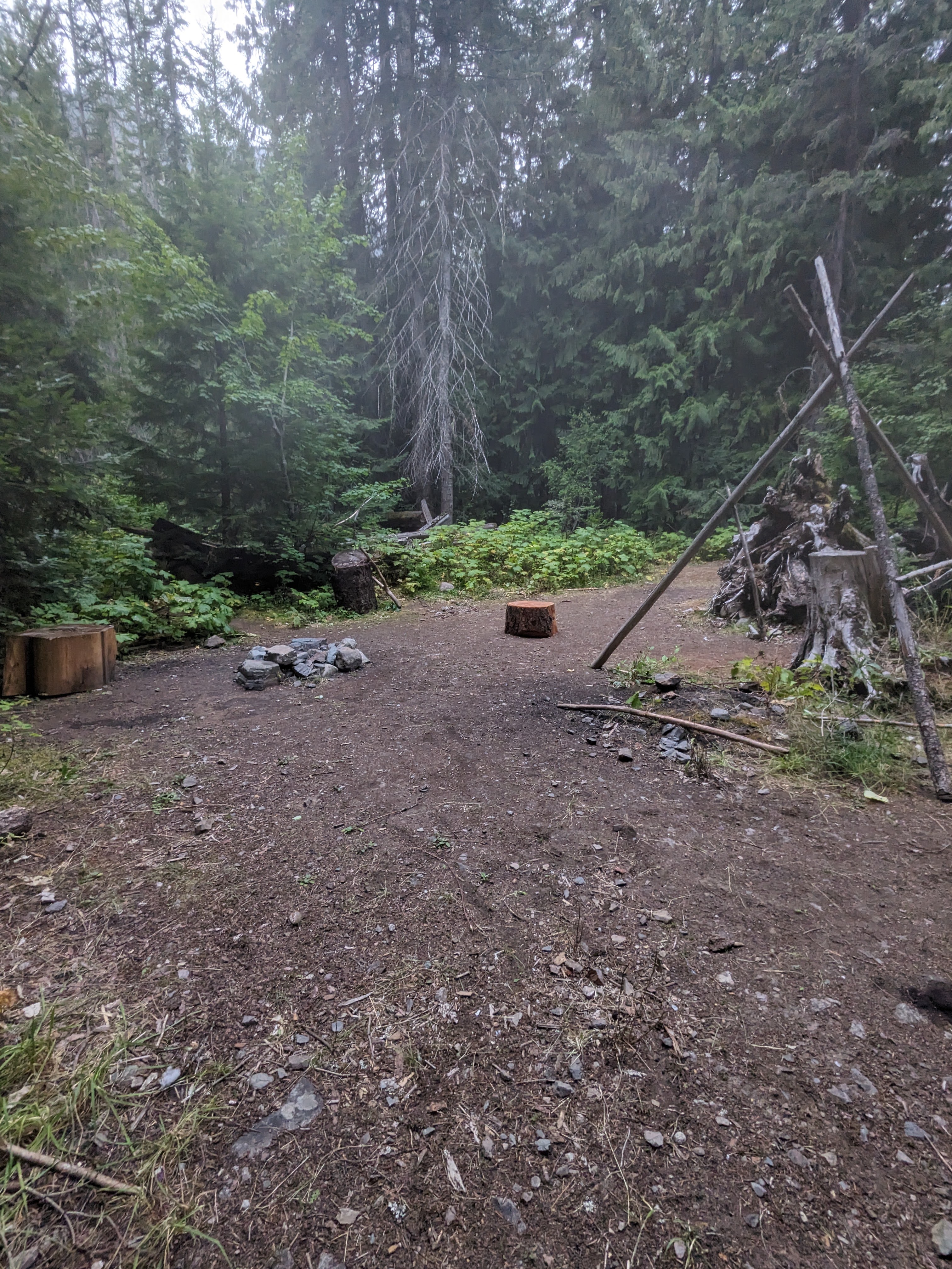
There are quite a few spots around the parking area where one could set up camp. I chose this spot and it offered quite a lot of privacy from the parking area. With some prudent placement, you could probably get five or six tents set up around here. If someone wanted to pack their gear a little ways further down the trail, there was a nice spot about 50 yds. into the forest that had a nice little view of the creek. There are no bathroom facilities at all once you leave Libby, so be prepared to be genuinely roughing it. There is no water asides from the creek either, so you will need to have that situation under control as well.
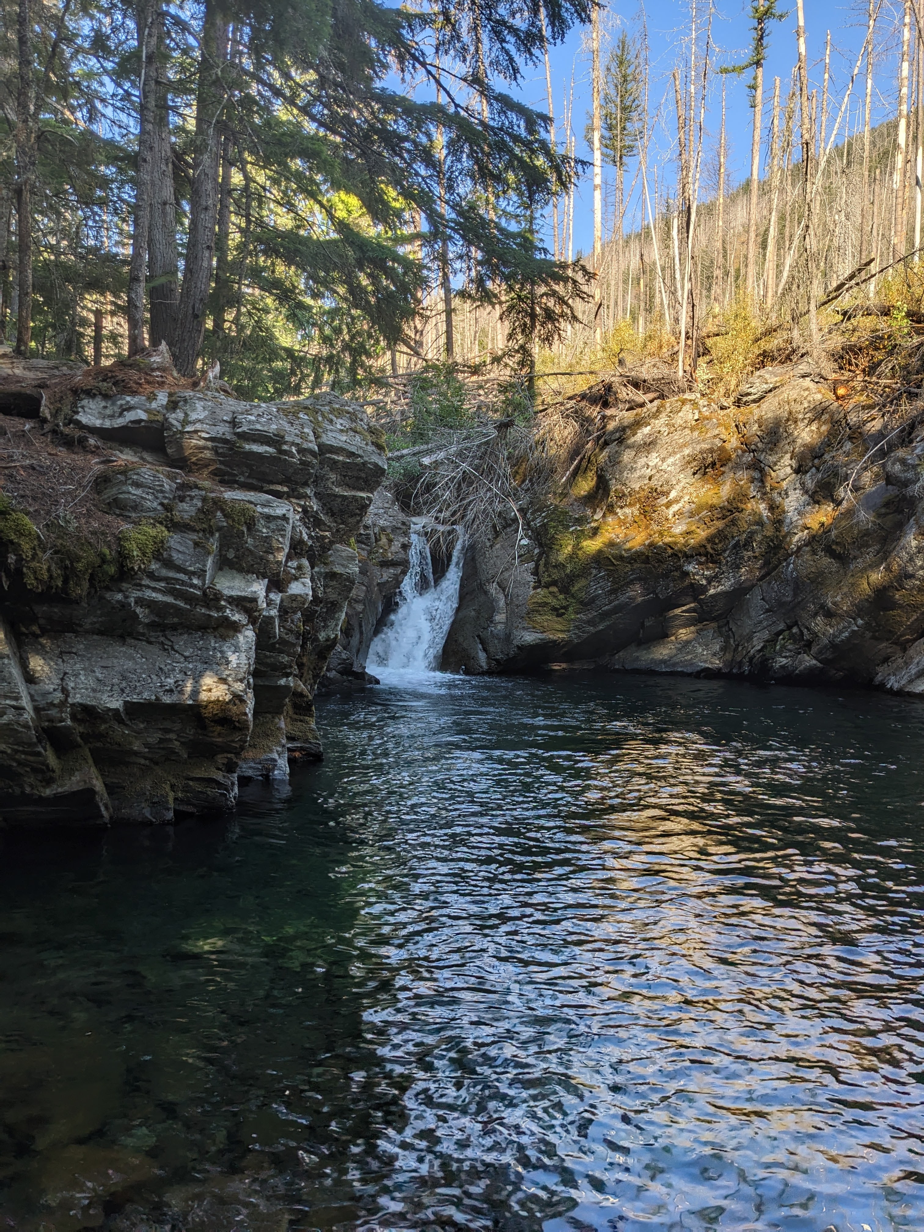
The trail starts from the parking lot and has been sort of muddy from the numerous springs coming down the hillside every time that I have been up here. After the muddy bit, it turns to large gravel and dirt. I saw somewhere that said the first couple of miles to Granite Creek Falls could be considered a family hike, but I think that would only be true if the kids are a little older and you have patience. There are a few minor stream crossings on the way to the first creek crossing, which is facilitated by a pretty cool log that was cut down and trimmed to make walking across it easy. There is a great camping area by the falls in case you want to spend the night by the waterfall. Should you decide to press on to the lake, the next four miles are a bit more strenuous and I do not think they are family friendly. I do not really think they are friendly for those that are, like myself, a little too much out of shape. All the hikers that my cousin and I encountered were in their twenties, if I had to guess, and in much better shape than us.
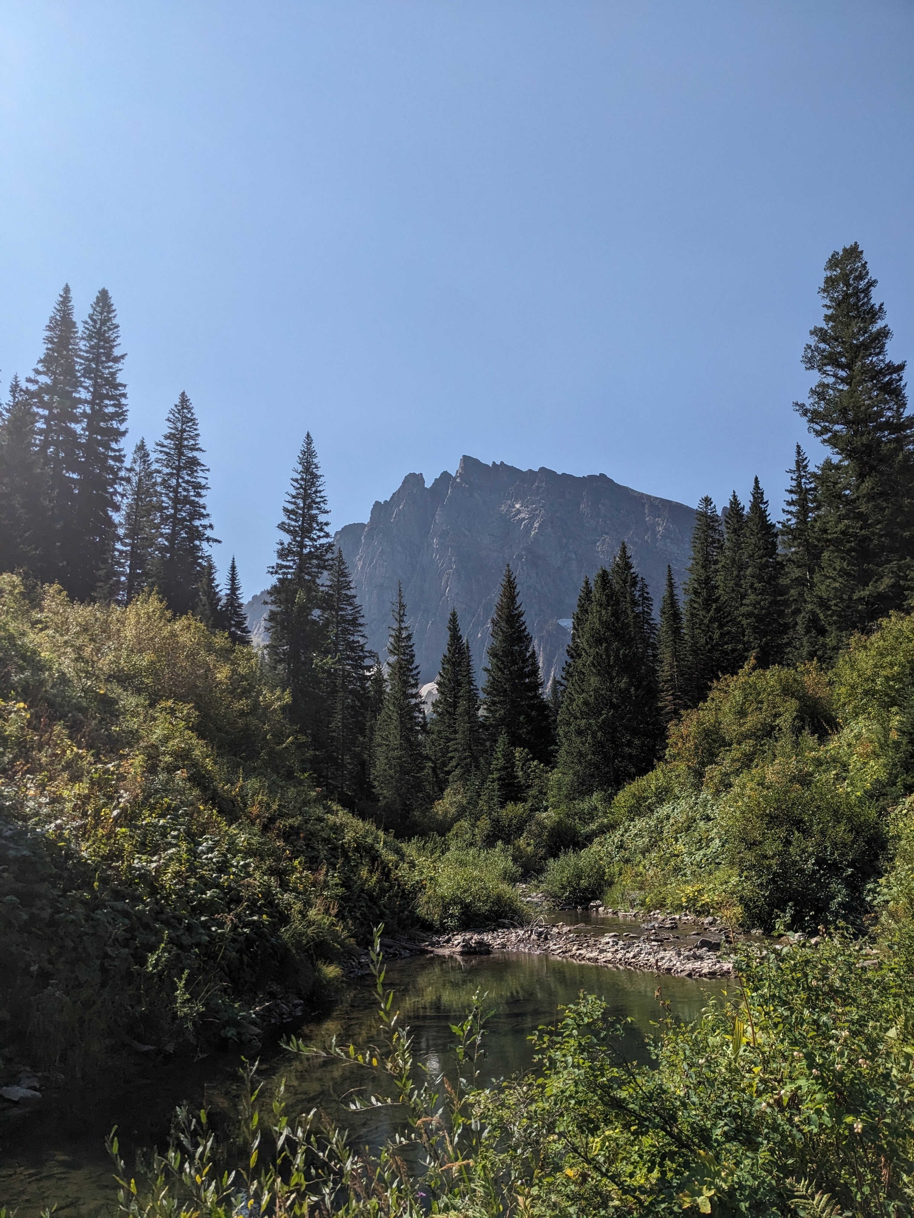
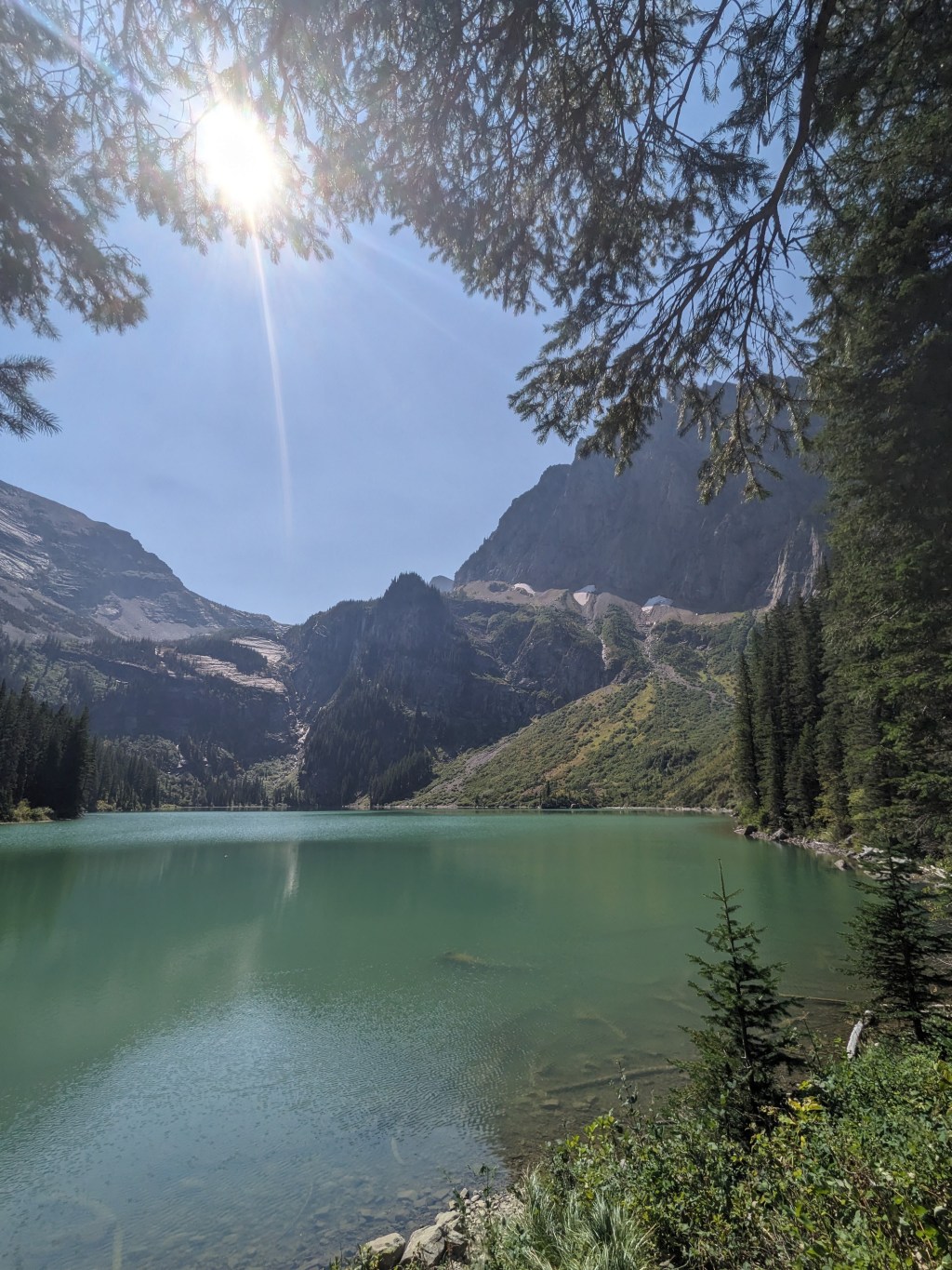
After the falls is another tree that has fallen across the creek and offers a dry crossing for those venturing up to the lake. The path continues to be pretty easy to follow, tho there are a few places where the bushes encroach on the path, their leaves hiding the roots and rocks that could trip you up if are not paying attention. The next creek crossing denotes the start of what is probably most of the elevation gain for this trail, which totals 1400 ft. over the length of the trail. Glimpses of ‘A’ Peak start to appear as you move further up the mountain side and move away from the creek. Eventually the path returns to the creek and the final crossing. There were rocks available for another dry crossing, so we managed to keep our feet dry for the whole trip. I believe that in early spring or after a lot of rain, this may not be possible and you may have to cross in about knee height water at worst. The path becomes highly overgrown with vegetation at this point, tho it is not easy to lose it. There are glimpses of two pools that have formed below the lake and their color was the strangest green-blue that I have seen for a lake.

Once at the lake, there are quite a few camping spots to choose from. Fly fishing looks like it would be great fun, for the fish never quit jumping the whole time that we rested at the lake. In all honesty, I would make this trip a two day affair, packing in what you need for an overnight stay. It felt like we rushed the trip and could have explored the lake and possibly the snow that still remained on ‘A’ Peak if we had had more time. The sound of the water running down the mountain side could be heard from the opposite bank and the water was quite cool. We did not try to swim, but there were some campers who were in the water. In total, our there and back trip took eight and a half hours. It was hard on both of us, but it was absolutely worth it also. I think this hike is for anyone that wants to just enjoy the forest and the lake and all that nature has to offer here. We saw squirrels, chipmunks, grouse, snakes, toads, butterflies, and signs of elk and bear. For the most part, the area was also devoid of commercial air traffic noise, as I did not hear a single jet overhead during the time I was there.
For a bit more information:
If you want more content, give me a follow on Instagram at: overnightadventuresblog
If Facebook is your thing, here is my page: https://www.facebook.com/overnightadventuresblog/
And finally, if you would like to help support my travels and this blog, here is my patreon link: https://www.patreon.com/OvernightAdventures
Disclaimer: The information contained in this blog is for informational purposes only and is not intended to be a substitute for professional advice. The author of this blog makes no representations or warranties of any kind, express or implied, as to the accuracy, completeness,or suitability of the information contained in this blog for any particular purpose. The author of this blog will not be liable for any loss or damage arising out of the use of or reliance on the information contained in this blog.

You must be logged in to post a comment.