
McCroskey State Park is in the state of Idaho, about 10 miles north of Potlatch on hwy 95. There is another entrance to the park on hwy 95 just south of Tensed. All entrances from the Washington side of the park originate in Farmington. I have rode the Pidgeon Hollow Road before and can attest to its’ suitability for most vehicles. It looks like one could take Evergreen Rd to Simmons Rd to Pine Creek Rd and access the park that way as well, but I have cannot verify the ease of travel on this route.
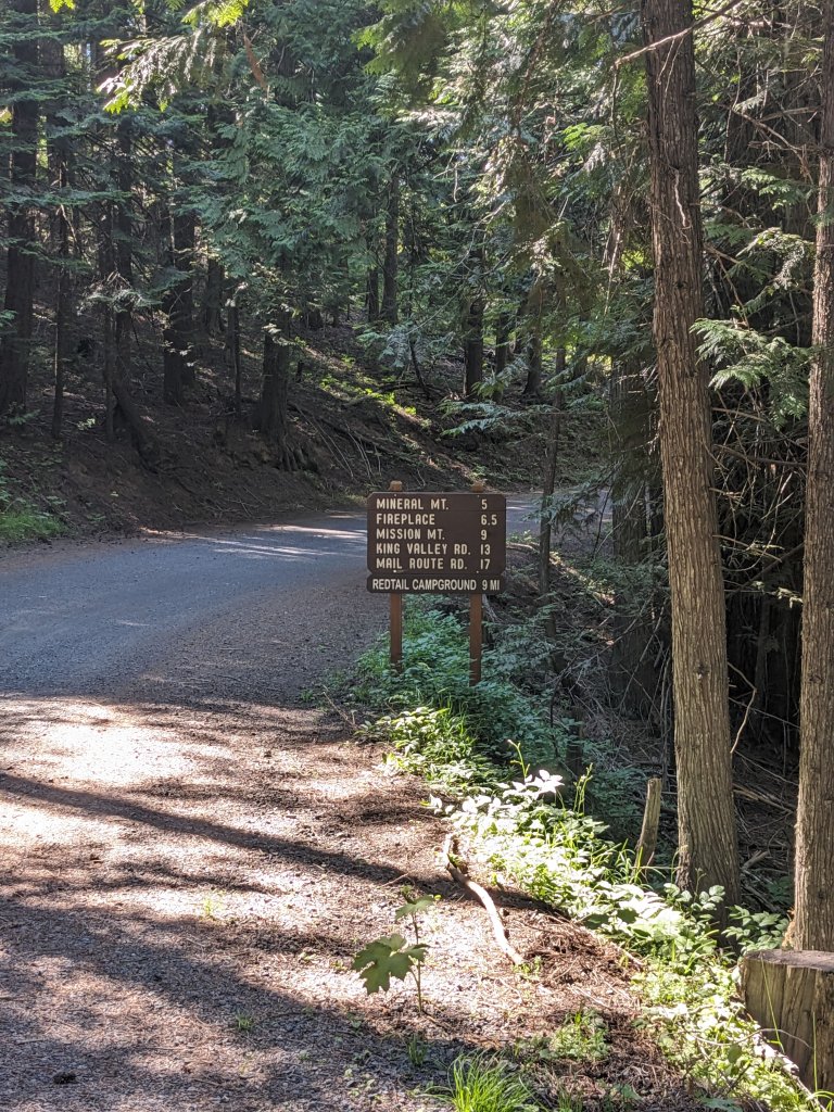
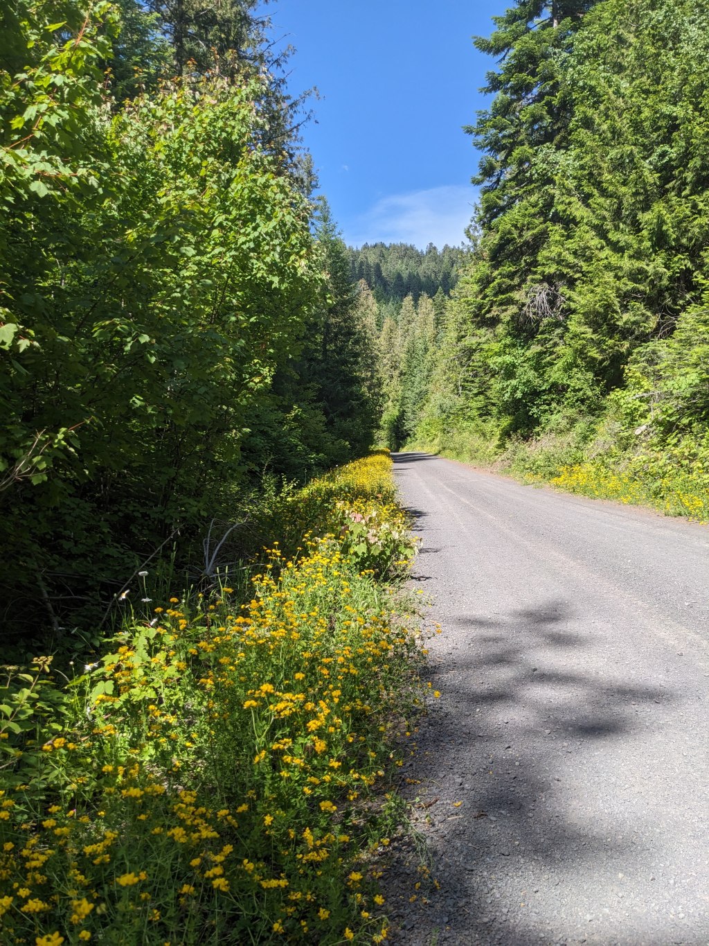
This is the entrance to the park from the southern most entrance on hwy 95. This is also the widest the road gets. The majority of the time, the road is wide enough for one vehicle. There are numerous pull outs and it does sometimes get wider on the corners. I think any car with at least 5″ ground clearance can take this road, but the lower the vehicle, the more care you will want to exercise unless you do not like your undercarriage. As the above mileage indicator shows, there are quite a few campgrounds in the park.
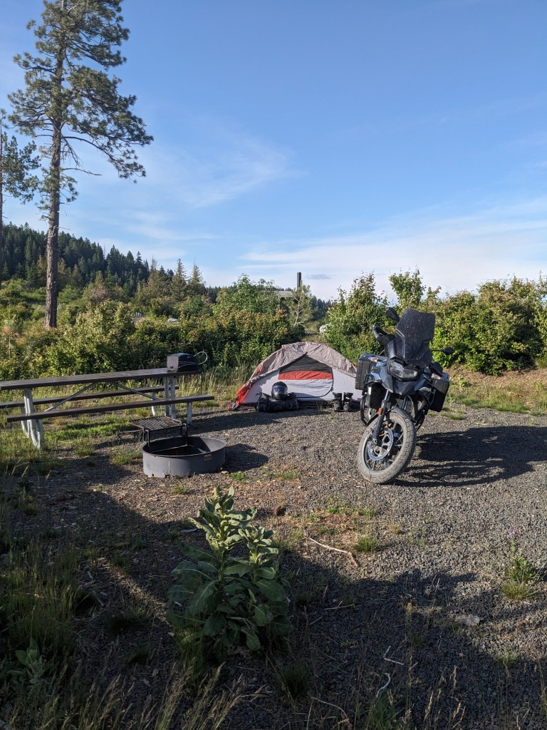
I ended up camping in Redtail Campground. There was no one else there and I wanted the luxury of a table this weekend. There were roughly 8 campsites, all with fire pits, tables, and a nice flat place for a tent to be set up. I do not recommend trying to drive in less sturdy tent pegs because the ground is just too hard to accept pegs. The western-most sites had wind breaks as they are pretty open to the wind, offering better views as well tho. There was also a potable water faucet that is seasonal use.

I did not ride up to Mission Mountain campground, but I did see the vault toilet from Skyline Dr when I left Redtail campground. Fireplace campground offers up two camping spots and a large picnic shelter that can be reserved up to 9 months in advance. Iron Mountain campground offered up another two camping spots and a vault toilet. There were numerous places where a camp could be made along the main road as well as off some of the side roads. I did also see one location where potable water could be acquired on the road.

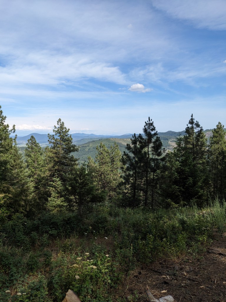
There are many trails in the park, and as far as I was able to ascertain, many of them are multi-use, where ATVs or motorcycles could be operated as well as being hike-able trails. There was some signage in the park that indicated trail routes. There were also many signs providing information about the forest, how fire plays a role in the life cycle of the forest, animals and birds that are present, and how the park came to be and the effort that Virgil McCroskey went through to make the park. There were a few signs indicating what you were looking at, such as Steptoe and Kamiak Buttes (as seen above, Steptoe is the pyramidal shaped one to the right, and Kamiak is the long butte on the left) and King Valley (pictured below).
Overall, I would highly recommend at least driving through the park. It might take a few hours, but entry is free, camping is free, and the views and ecosystem are quite amazing. I do not think that the road is maintained in the winter, but a spring visit, while the flowers are in bloom, would be a great time and well worth it.
For more information: https://parksandrecreation.idaho.gov/parks/mccroskey/
If you want more content, give me a follow on IG at: overnightadventuresblog
If Facebook is your thing, here is my link: https://www.facebook.com/overnightadventuresblog/
And finally, if you would like to help support my travels and this blog, here is my patreon link: https://www.patreon.com/OvernightAdventures
*Disclaimer:* The information contained in this blog is for informational purposes only and is not intended to be a substitute for professional advice. The author of this blog makes no representations or warranties of any kind, express or implied, as to the accuracy, completeness, or suitability of the information contained in this blog for any particular purpose. The author of this blog will not be liable for any loss or damage arising out of the use of or reliance on the information contained in this blog.

You must be logged in to post a comment.